Indonesia
|

|

Regional Map of Indonesia
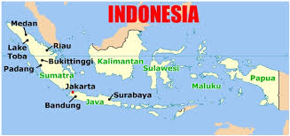
Map of Indonesia
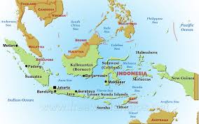
Map of Indonesia Captial

Area
Total: 1,904,569 sq mi
Land:1,811,569 sq mi
Water: 93,000
Total: 1,904,569 sq mi
Land:1,811,569 sq mi
Water: 93,000
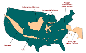
Indonesia Compared to US
Countries that Share a Border
- Timor-Leste
- Malaysia
- Papua New Guniea
Boundaries
- Land: 2,958 sq mi
- Coast: 54,716 sq mi
Climate
Tropical, hot, humid; more moderate in highlands
Tropical, hot, humid; more moderate in highlands
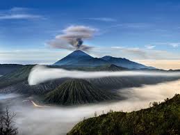
Terrain
Coastal lowlands, mountains on specific islands
Coastal lowlands, mountains on specific islands
Elevation
Highest: Puncak Jaya (4,884 meters)
Lowest: Indian Ocean (0 meters)
Highest: Puncak Jaya (4,884 meters)
Lowest: Indian Ocean (0 meters)
